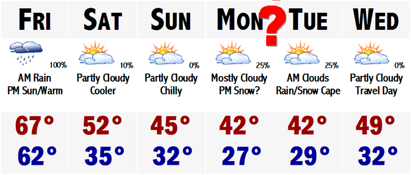
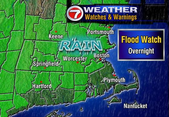
Its 70 degrees in Boston right now at 2:30PM. We beat the record high previously held by an 1885 temperature of 68 degrees. Tomorrow will be another warm one with highs in the mid to upper 60's again. Rain will develop during the morning and become steadier and heavier as the day progresses. We could get a thunderstorm too, with up to 1-2" still of rain. Nothing compared to the 12-18" of snow in northern Oklahoma today with a swath of 6-12" from KC to STL to CHI. We will be missing out on that one.
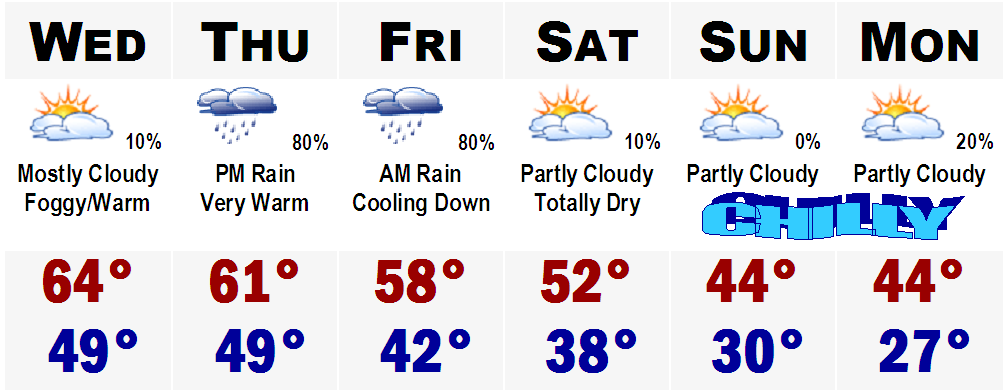
It also looks like we will be missing out on the Monday storm as well. I was hesitant to take it completely out of the forecast, but run after run since last night of the GFS has continued to take this storm well out to sea, perhaps giving the Cape and passing flurry or sprinkle. The cold behind the storm does not look to be as harsh as previously thought as well. It will still be chilly with highs in the upper 30's, but not the upper 20's it looked like yesterday. This is mainly because yesterday's runs were taking into effect a snowcover, which is not going to happen now. I should have stuck with my guns in the beginning telling Jen to fo-get about it. The Canadian that was showing a hit yesterday is taking this storm even further out to sea than the GFS now. I am not buying into this storm. Its going to be a bust! Do not get your hopes up, just pretend there was never any chance of it coming here and you'll feel better. No snow looks to be in our immediate future.
As Eric and Ray say...NEXTTT!!!!!!!