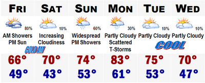
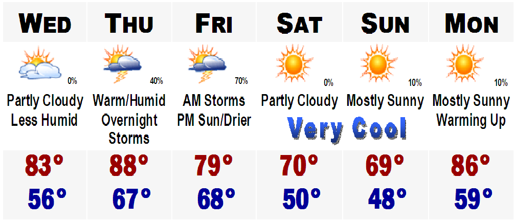
Today is the last day of the extreme heat, especially south of the Mass Pike. Highs today before the thunderstorms of this afternoon will be into the middle 90's. A few upper 90's are possible by 1-2PM especially near Brockton and Taunton. Dewpoints are still in the mid 70's, making it feel like around 105 this morning and afternoon, hence we are under a Heat Advisory like the banner says, south of the Pike.
Storms are expected to develop this afternoon and come down from the north and move south. A few of these storms could be severe, with strong winds in excess of 60mph, torrential rains, and large hail. You will know when the front moves through the area. Winds will turn from the warm west, to the cooler northeast. Temperatures will fall 10-15 degrees immediately after the front moves through.
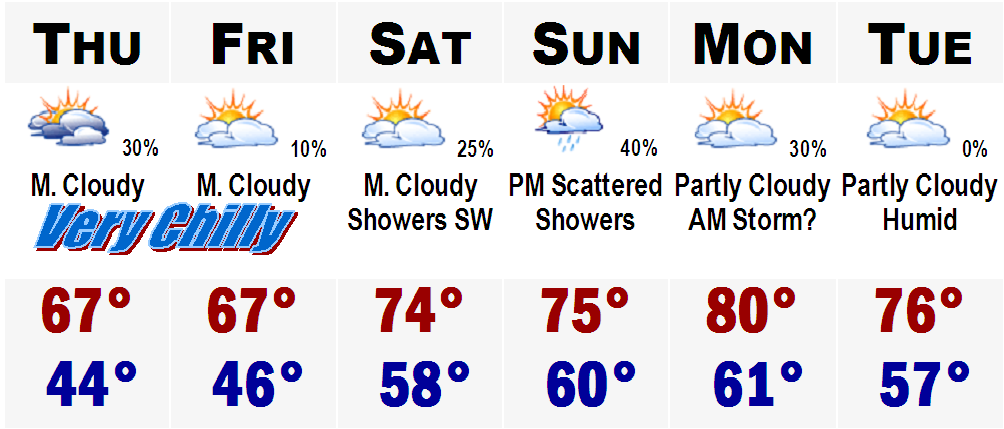
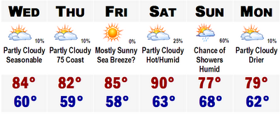
Tomorrow should start out with a few morning showers, especially on the Cape with highs in the lower to mid 80's in Boston's western suburbs. Boston may be cooled by a seabreeze and only see highs in the upper 70's dropping into the lower 70's in the afternoon.
The Cape will be cooler tomorrow and really start to dry out after the morning hours. Highs on the Cape tomorrow should range from between 72 degrees on the shore to 78 degrees in the city of Hyannis.
This weekend looks to be the best in quite some time. Everywhere from the Cape to northern Maine should see clear skies Saturday and Sunday with highs in the upper 70's to mid 80's in the warmest suburbs of Boston, CT, and southern NH.
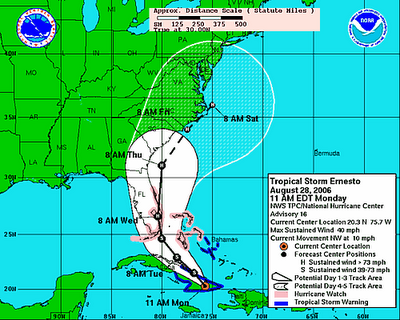
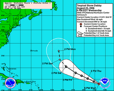
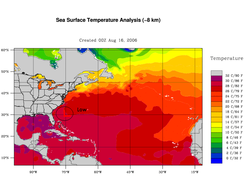
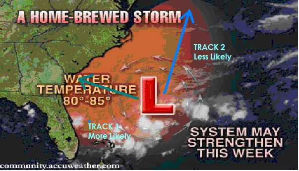
TROPICAL STORM CHRIS UPDATE
After looking impressive on the satillite yesterday T.S. Chris has really fizzled and maximum susstained winds are only 40 mph and all the convection has moved away from the center and the eye is now totally exposed. Expect it to weaken to a depression soon, but then we may have to watch it later on once it gets out to the Gulf, if it does.


 We got some believe it or not, much needed rain this morning with many areas of southern New England picking up .4" to .7" of rainfall.
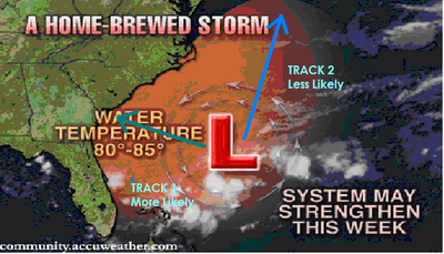


