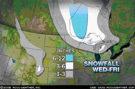
 Here comes the snow. A nice three day snowstorm for many up there in the northern Plains and Great Lakes. It will start with some system snow, the initial burst of about 3-6", perhaps 7" of wet snow in the white shaded area and then there will be some lake effect snow showers in the UP of Michigan. In the blue shaded area above, 6-12" of snow is likely, but new information suggests that this area, especially higher elevations may see up to TWO FEET of the white stuff.
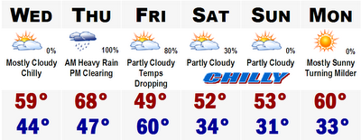
Notice the wide area of 6"+ in Canada. That is very important and will act as a refridgerator and make these cool shots even colder and keep them cold. A cold surge will move into the area later this week as it shows in the 5 day forecast below.
No comments:
Post a Comment