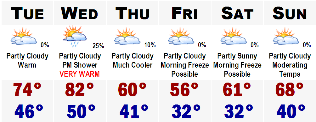
Yet again, summer weather is returning to SNE. Highs tomorrow will range from the lower 70's along the east facing coasts of SNE to mid and even upper 70's west of the CT River, especially in southwestern CT. It will only get warmer Wednesday as we will really be feeling INDIAN SUMMER. Highs will be in the upper 70's regionwide and even lower 80's in Boston's immediate suburbs. Places that could see 80+ include, Bedford...Norwood...Taunton...Natick...Framingham...Concord...and Woburn.
That will be shortlived though as a cold front will move through the area on Wednesday night and highs on Thursday will struggle to get into the low 60's after morning lows in the low 40's. Friday will be the coolest day of the next six with highs staying in the 50's all day. Morning lows will likely drop down to frost levels and likely hard freeze levels on Friday morning and Saturday morning with lows ranging from the upper 20's in the coldest "burbs," to around 40-45 in the city of Boston.
The cold will also be shortlived as highs Sunday could be pushing 70 once again.
The ROLLERCOASTER ride continues.
No comments:
Post a Comment