 I know that the swath of snow with this clipper looks ominous, but I highlighted the areas in light blue that have a chance of seeing at least a half inch of snow. Most places in the light blue will generally see a coating to one inch of sloppy snow. Where the darker blue is, is where we will see snowfall totals closer to the 3" mark. These areas will be confined to the UP of Michigan and northeast Pennsylvania, where the 00z NAM is absolutely clobbering with up to 0.75" accumulated QPF. It will be cold enough for most of this to be snow, with temperatures in the mid 30's to start, but falling into the upper 20's during the night in northeast PA. Scranton, PA may wind up with 3-4" of snowfall, believe it or not. I have most of the state of New Jersey and even New York City in the light blue. Accumulation in NYC and near the Jersey shore will be little or none. There will be flakes falling from the sky, however, Friday night in most of New Jersey and in Times Square. All of this will snake southwest of most of southern New England, leaving us high and dry. The ocean storm will miss us and the snow from this 'Norlun' type trough will miss us as well. Stay tuned though.
Wednesday, November 07, 2007
Snows from Clipper
I know that the swath of snow with this clipper looks ominous, but I highlighted the areas in light blue that have a chance of seeing at least a half inch of snow. Most places in the light blue will generally see a coating to one inch of sloppy snow. Where the darker blue is, is where we will see snowfall totals closer to the 3" mark. These areas will be confined to the UP of Michigan and northeast Pennsylvania, where the 00z NAM is absolutely clobbering with up to 0.75" accumulated QPF. It will be cold enough for most of this to be snow, with temperatures in the mid 30's to start, but falling into the upper 20's during the night in northeast PA. Scranton, PA may wind up with 3-4" of snowfall, believe it or not. I have most of the state of New Jersey and even New York City in the light blue. Accumulation in NYC and near the Jersey shore will be little or none. There will be flakes falling from the sky, however, Friday night in most of New Jersey and in Times Square. All of this will snake southwest of most of southern New England, leaving us high and dry. The ocean storm will miss us and the snow from this 'Norlun' type trough will miss us as well. Stay tuned though.

Nice November Cooldown
 We are about to embark on a nice November cooldown. The next 4-5 days will be below average in temperatures, mainly in the 40's, but the most important thing will be that it will be dry. We had that weekend storm threat, but it has been off the maps for the past 2 days so it looks like it is finally out of our forecast. It may throw an ocean effect sprinkle down on the Cape or South Shore Saturday afternoon, but that would be just about it. We will really be cold though. Morning temperatures tomorrow will be ranging from the upper 10's in the coldest suburbs to around 30 in the city of Boston. We have our coldest moring on Friday with more 10's and 20's and if Boston doesn't get a freeze tonight, they will Friday morning. The miss is on Saturday and then we slowly start to warm up to a few degrees above normal by Tuesday of next week, ahead of the next storm system. Next week's forecast is of low confidence because there will be wavy fronts all over the place and the eventual storm track of a major storm will dictate our weather, whether we turn white or damp.
Tuesday, November 06, 2007
Weekend Storm is a No Go...
 The once promising weekend storm that looked to deliver our first snowfall has fallen through the cracks today. All models have taken the GFS route and have totally taken this storm way out to sea and barely has it develop out at sea. Its a no go. Also, the cold shot behind today's rain does not look as severe as it did a few days ago. It has really moderated to near seasonable levels, only slightly below normal highs on Thursday through Saturday, but next week, the jet will flatten to allow some mild Pacific marine air into the lower 48 and we will all see moderating temperatures. By Monday of next week, we could be seeing highs in the low 60's as a storm system will be starting to cut through the Lakes, which will push in the SW gales and warm gales at that. There are signs that a storm will try to split with one that goes through the Great Lakes while the other one stays back an allows to first to deliver some cold air to the northern States, towards the middle of next week, allowing the southern piece of the storm to develop in the TV and head NE towards the northeast with a swath of moderate to heavy snow somewhere from Chicago to northern NJ and New England. If Chicago gets a snowstorm, we will stay on the warm side and see a showery week with abnormally high temperatures in the 60's. We'll see how that works. Its a long way out.
 Enjoy our tranquil week, weatherwise, this week. The NAO is tanking later next week, so the storminess will return after todays heavy rains.
Monday, November 05, 2007
Computer Models on Weekend Storm
 This first computer model is from the 12z EURO model. As you can see, it does dip that trough enough to develop a fairly good storm, but the progressive flow keeps that storm system moving offshore as it strengthens. This image is for sometime around midday Saturday, the 10th of November. Without the precipitation forecast, I would expect little to nothing in the way of precipiation with this model outcome, but there may be enough to throw a few sprinkles and flurries in towards southern New England, especially south of the Massachusetts Turnpike, I-90.
The EURO's 12z is an in between the more aggressive GGEM (Canadian) and the meager solution on the GFS, the American model. The GFS keeps a very progressive NW flow as the clipper moves along as a dry area of low pressure mainly with lake effect rain/snow showers. The GFS does develop a storm, but it develops it way out to sea and not even a real threat to boaters near the coast. The next grid of computer model will be the GGEM. This is the one going gangbusters with a big dip in the jetstream as a low pressure will get cranking right around Nantucket, bringing in NE gales to the coast. It would be a quick mover, but would deliver a good thumping of heavy wet snow over the interior of southern New England and even light to moderate snow over Central New England and Maine, bombing out the storm as it heads towards Nova Scotia.
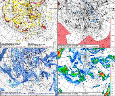 The GGEM is much more aggressive with the deep trough developing, making a huge ocean storm, alla the Nor'easter solution. I am not sure if this will pan out because it is the extreme, delivering a massive early season snowstorm to parts of southern New England. That said, I am not quite yet buying the GFS solution for it is basically not picking up the storm on its OP run yet, but it is showing an amplification along the East Coast that could support cyclogenesis development. Its just not showing anything at this point, both the 12z and 18z OP runs, but this mornings 06z OP run was looking more like the GGEM OP run.
 Of note, around this period, the NAO is to go from positive towards negative and likely being nuetral around November 11th or so. When the NAO goes from positive to negative or negative to positive, through neutral, that is when we usually get our biggest storms. This is just something interesting to note.
Right now, I wouldn't rule anything out for this weekend. We know how all the models were taking Noel out to sea for much of the week until about two days before the event, so we will see if it doesn't just do the same with this one as well for this weekend.
Another Nor'easter
 Another Nor'easter could be in the works for later this week and weekend. The computer models are continuing to show this storm system with marginal temperatures between rain/snow. Its going to be a real close call. First of all, we have a rainy Tuesday coming with a bout of some heavy rainfall associated with the frontal system. All said and done, much of southern New England will see between one half and one inch of rainfall out of this storm system. This will usher in some much colder air later in the week with highs in the 40's for the rest of the week with highs likely in the upper 30's on Friday ahead of a storm sytem coming out of the Great Lakes and redeveloping along the coast and ever so slowly moving up to Nantucket with a band of precipitation making it all the way into southern Vermont and central New Hampshire. This could last into Saturday with a tossup between rain and snow. Generally, the further away you get from Boston, the better chance you will have at seeing some snow.
 Here is what the Boston Forecast Discussion is saying about this event...
HIGH PRESSURE WILL SLIDE OFFSHORE ON FRIDAY AS A FAIRLY POTENT UPPERLEVEL TROUGH APPROACHES FROM THE WEST. THE 00Z GLOBAL MODELS HAVECOME INTO BETTER AGREEMENT WITH EACH OTHER REGARDING THE EVOLUTIONOF THE APPROACHING SYSTEM. ALL OF THEM /EXCEPT THE ECMWF/ NOWDEVELOP A COASTAL LOW OFF THE MID ATLANTIC COAST SOMETIME FRIDAYNIGHT...THEN MOVE IT NORTHEAST WELL TO THE SOUTHEAST OF NANTUCKETSOMETIME SAT OR SAT NIGHT. THE 00Z OP GFS...00Z GFSENSEMBLE...UKMET...GGEM ARE IN DECENT AGREEMENT WITH THIS.WILL
THEREFORE INTRODUCE LOW CHANCE POPS ACROSS THE SOUTHERN HALF OFTHE CWA FRIDAY NIGHT INTO SATURDAY NIGHT. WILL HAVE TO WAIT FOR THEECMWF TO COME INTO BETTER AGREEMENT BEFORE HAVING ANYTHING MORE THANLOW CONFIDENCE. HOWEVER...IF THE 00Z MODEL CONSENSUS PANSOUT...PORTIONS OF SOUTHERN NEW ENGLAND COULD SEE THEIR FIRST MEASURABLE SNOWFALL OF THE SEASON /ALBEIT QUITE LIGHT/. THE COASTALPLAIN LIKELY STAYS LIQUID AS BOUNDARY LAYER TEMPS WILL BERELATIVELY WARM.
We will see how the computer models go this afternoon....
Sunday, November 04, 2007
Turning Very Cold; Snow Late Week?
 Enjoy the 50's while we still have them. We will be falling into the 40's for the majority of the week this week after Tuesday's rains. First tomorrow will be a nice day with the slight chance of a few sprinkles, especially over southeastern MA and RI. The rain on Tuesday will be associated with a cold front and will move through the area late tomorrow night and early Tuesday morning. We are not talking inches upon inches of rain, but just enough to mess up the morning commute. It will clear out later in the afternoon and the cold air will rush into southern New England. Wednesday and Thursday will be very cold with highs in the low-mid 40's. Friday morning clouds will roll in and light snow may develop in southern New England from a clipper type system with a borderline rain/snow event for the northern Mid Atlantic and southern New England. The GFS has been advertising this event for a while now and could be showing us when our first snows will be.
 These clipper type storms can be there one day and the next be vanished, so stay tuned, but for the last few nights, the GFS has been showing something for next weekend. Stay tuned.
Until then, bask in the glory of a Celtics OT win this afternoon against the Raptors and the AMAZING win by the Pats over the dreaded Colts and Manning tonight. 9-0!
Saturday, November 03, 2007
Winter Weather Looming
 Winter weather is only about a few days away from entering southern New England. The rain and wind will end tonight after about 1-3" in the Boston metro area and 3"+ down on the Cape. Tomorrow will be a nice day to dry out with mostly sunny skies and temperatures into the mid and upper 50's. Then we will see the clouds roll back in on Monday with some rain showers developing on Tuesday with the threat of rain the entire day as the cold air will be waiting behind the arctic cold front. Then we get to some early level wintertime cold with highs in the mid 40's on Wedesday and then around 40 on Thursday and Friday with the threat of some type of storm system moving in from the Great Lakes later Friday that has been all over the place on the models for the past few days. Some days it looks like we will get it looking like we will be hit hard and others, not so much. We will see.
 Winter Storm 'Noel'
 I thought this was very interesting. If you haven't been outside, you will notice that it is very chilly out there in southern New England. Its nearly 1PM and the temperature outside my window is 42 degrees with winds up to 20mph, making it feel more like 35 degrees. There is real cold in northern Maine and that is where the National Weather Service currently has a WINTER STORM WATCH in affect for much of northern Maine. All the moisture from the leftovers of Hurricane Noel will move into northern Maine later this afternoon and evening, hit the temperatures in the low 30's and we have snow. It will be a bonified snowstorm for northern Maine. Here I outlined where the heaviest of the snow will fall. In extreme NW Maine in northwest Aroostook County, I am forecasting a heavy 6-9" of snow with a few places maybe picking up close to one foot of snow in the highest elevations. Further south into Caribou, there will be a good 4-7" of heavy wet snowfall that could cause some local power outages, but since most of the leaves are off the trees, I think they will be spared the worst. Finally further south from there, a slushy 1-2" of snowfall is possible. Maine is like a different country here in our six state region. Only Maine will see a winter storm out of a tropical storm. Winds will gust up to 60mph during the peak of the snow tonight and a few claps of thunder are also possible. The news hasn't really picked up on this side of Noel for the Cape is really getting blasted with up to 3-5" of rain and wind gusts in excess of 85mph later this afternoon.
 Finally, I want to remind everyone that we are getting an extra hour of sleep tonight because we are returning back to standard time. The sun will be setting at around 4:35 tomorrow afternoon. The sun will be out tomorrow and we will have highs in the mid 50's, so it will feel much better than today, but the winds could still be a bit gusty, but only up to 30mph at the coast.
Sit back and enjoy the storm.
Friday, November 02, 2007
Stormy Saturday: Hurricane Force Wind Gusts Likely
 There it is. This storm is going to be a ramped up Nor'easter for eastern SNE. And I want to stress that eastern SNE will see all the action. The area in the light blue is where most of the action will happen, but if I did this graphic, I wold put the Cape and Islands in a red color. Here wind gusts may exceed 85-90mph at the peak of the storm. The extratropical Noel will pass just about 100 miles SE of Nantucket, so that is why the Cape will see such damaging conditions. There may likely be some power outages due to downed branches and trees down on the Cape. It will get that bad. Off the coast of the Cape, there is a Hurricane Force Wind Advisory, meaning that there will likely be wind gusts exceeding 75mph much of the time. No doubt this will cause the seas to really build. Off the coast, seas will build up to 40 feet, so shippers should be aware and stay in port to let this one go by. Its not worth it. At the coast, there will be a surfer's delight, with waves at the shore approaching 22-28 feet high. It will undoubtedly cause a surge, but we are in between the new moon and full, so astronomical high tide will be low, so we will only see a storm surge of 1-2 feet.
 Here is a breakdown.
WIND:
Cape..........Peak sustained at 40-55mph; gusts to 85+
Boston.......Peak sustained 30-45mph; gusts to 65+
Worcester.......Peak sustained 15-25mph; gusts to 35+
RAIN
Cape...........Extremely Heavy, Flooding Likely; 4-8"
Boston.........Heavy, Flooding Possible; 2-4"
Worcester.........Light to Moderate at times; Less than 1"
___________________________________________________________________So as you can see, the Cape and southeastern Massachusetts will see much of the action tomorrow. If you are in Vermont this weekend, tomorrow will be a nice day with partly cloudy skies and temperatures in the 50's. In eastern SNE, highs will only make it into the low-mid 40's with wind chills likely in the upper 30's. Sunday will be much better with everything clearing out and highs getting back into the mid and upper 50's. It will be a good day to clean all the debris out of our yards. Down the Cape, you may have more work to do than the rest of us.
Be safe tomorrow and don't be stupid and go surfing with 85mph winds. I suggest everyone from Boston on SE just stay home and watch the storm from the window. It will be much safer that way. This storm has already killed over 20 people, so be careful.
Thursday, November 01, 2007
HURRICANE NOEL TO MAKE CLOSE PASSING
 Seemingly out of nowhere, once Tropical Storm Noel that looked to measly just head out to sea and weaken is starting to move westward on the models, strengthen, as it already has at the 8PM update, now Hurricane Noel with winds of 75mph, is going to link with a stationary front that is moving through our area tonight, over the ocean and form the Perfect Storm. Noel will start losing its tropical characteristics tomorrow, but it will still gain strength, as it becomes extratropical, but will still be classified as a Category 1 Hurricane as it moves just to the SE of Nantucket on early Saturday morning. Some models are bringing this storm's strength to near Category 2 status, with winds approaching 100mph as it passes by the Cape. It is going to be a monster and since it will be losing its tropical characteristics and become a bonified Nor'easter, winds will extend very far from the center of the storm, so eastern New England will get into the show.
Here is the rainfall impact forecast for
SNE. As you can see, the Cape will bear the brunt of the storm with the heaviest rainfall. Some of the models are bringing nearly 3-4" of rainfall to the Cape and extreme southeastern Massachusetts. Then the rest of the eastern part of the state and region will likely see moderate rain with an inch or two possible. There will be a sharp cutoff in the rain so past Worcester County won't see anything. At least this is how it looks right now at this point. Winds will be another major issue with the trees still having most of their leaves, especially southeast, the wind will likely cause scattered power outages. Obviously, the Cape and the coastline will see the strongest of the winds. We are talking sustained winds of 35-45mph during the peak of the storm sometime Saturday with peak wind gusts over 60mph, perhaps approaching hurricane status down on the elbow of the Cape. Further inland, the winds will be strong (25-35mph) but not as strong as SE. For this reason all of eastern SNE is under a HIGH WIND WATCH at this current time and I would not be surprised if the Cape goes under a TROPICAL STORM WATCH later tomorrow. Just when you thought we were heading to winter, this happens. But wait, we are. The entire time this event is happening, cold air will be diffusing into the back side of this storm system and we will be seeing a windswept frigid rain, with highs in the mid-upper 40's.
This is a BIG DEAL and nothing to turn your back to. It will be DANGEROUS on Saturday with the winds blowing down trees and possible flooding with the heavy torrential rains, falling perhaps 1-2"/hr. This has come on the forecasting community kind of fast and tomorrow, I hope the news will allude to the fact that this could be a LIFE-THREATENING STORM for SNE, especially on the Cape. I don't want to sound like a dark forecaster, but this storm is going to catch a lot of people off guard.
Waves during this storm could approach 30-40 FEET just offshore, so do not go out fishing on Friday night and Saturday. It could be a LIFE AND DEATH situation if you decide to go out of port during this storm. I cannot emphasize that enough. Be safe and more on this rapidly developing situation later.
Stay safe.
Subscribe to:
Posts (Atom)